
Image
I love our weather. The forecast said it would rain most of the day Sunday. Early afternoon the rain stopped. It was almost 70 degrees (21 across the river.)
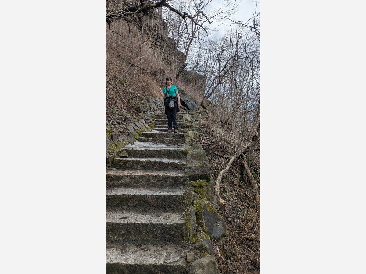
The sun was shining and the sky was blue. Beth headed out with Gord and me and we talked about heading for the flats, down the Whirlpool stairs and south.
We made it halfway to the diminished river (it is flowing at 25% because of how much water is syphoned to generate electricity.)
There was still significant ice. Gord was running ahead. Beth was trailing, being careful. We turned.
Our phones dinged. It was a National Weather Service Thunderstorm Warning. As you can see in the photo, the clouds had closed. In an instant, we had gone from nice-spring-walk to oh-hell-there-could-be-hail.
Lightning flashed in the distance. Thunder crashed above.
The rain and wind came hard just as we exited DeVeaux Woods. Gord did not care.
We missed the hail but made it home drenched.
The point of this vignette is that warning from our federal meteorologists might not be here 6 months from now but we will still be able to look up. Even when the sky was blue I can look up and see light, wispy looking clouds sailing above at high velocity and look south, from where our weather seems to approach and see thunderclouds coming even when the sun is shining.
It seemed like a nice day for golf.
Here’s a story from WBFO on the weather:
While many Western New Yorkers continue their St. Patrick's Day celebrations through Monday, much of the area is under a high wind and thunderstorm alert.
A severe thunderstorm warning remains in effect until 3:30 p.m. for eastern Wyoming, southeastern Cattaraugus, Livingston, Allegany, and southwestern Ontario counties. At 3:01 p.m. a severe thunderstorm was located near Cuba, NY, 13 miles northwest of Wellsville and moving northeast at 45 mph, according to the National Weather Service.
A severe thunderstorm was also located around Warsaw at a similar time. A large sever thunderstorm was spotted by NWS Buffalo extending from Newfane to Lockport, all the way to Lackawanna.
With wind gusts as high as 60 mph in those areas and periods of heavy rain, forecasters warn of damage to roofs, siding, and trees. Hail is also likely, roughly estimated under .75 inches.
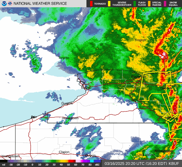
National Weather Service
The radar conditions from the National Weather Service Buffalo office around 4:30 p.m. Sunday.
While the chances of a tornado are only rated as "possible," the National Weather Service reminds that if you spot a tornado, get into a basement or small central room of a sturdy structure.
A wind advisory is in effect until 8 p.m. Sunday evening for Niagara, Orleans, northern Erie, and Genesee counties. Sustained winds 20 to 30 mph, and gusts as high as 50 mph.
For information about power outages and estimated restoration times, NYSEG customers can visit here, and National Grid customers can visit here.


Moderate rain, with a high of 83 and low of 68 degrees. Fog during the morning, cloudy for the afternoon, light rain shower during the evening, fog overnight.